

Following a successful launch on July 30, the NISAR satellite will orbit Earth for at least three years, using its sophisticated radar systems to scan nearly all the planet’s land and ice surfaces twice every 12 days. NASA and the Indian Space Research Organisation (ISRO) will jointly operate the spacecraft and gather science of high priority to both the United States and India.
Short for NASA-ISRO Synthetic Aperture Radar, NISAR will help scientists better understand processes involved in natural hazards and catastrophic events, such as earthquakes, volcanic eruptions, and landslides. In addition, it will support monitoring of infrastructure, such as dams, bridges, and roadways. What’s more, the satellite’s cloud-penetrating ability will help urgent-response communities during weather disasters such as hurricanes, storm surges, and floods. And NISAR will provide key global Earth observations, such as changes in ice sheets, glaciers, and sea ice, as well as improve understanding of how deforestation, permafrost loss, and fires affect the carbon cycle.
Along with providing an unprecedented amount of data, the mission breaks new ground with its collaboration between teams of scientists and engineers separated by more than 9,000 miles and 13 time zones.
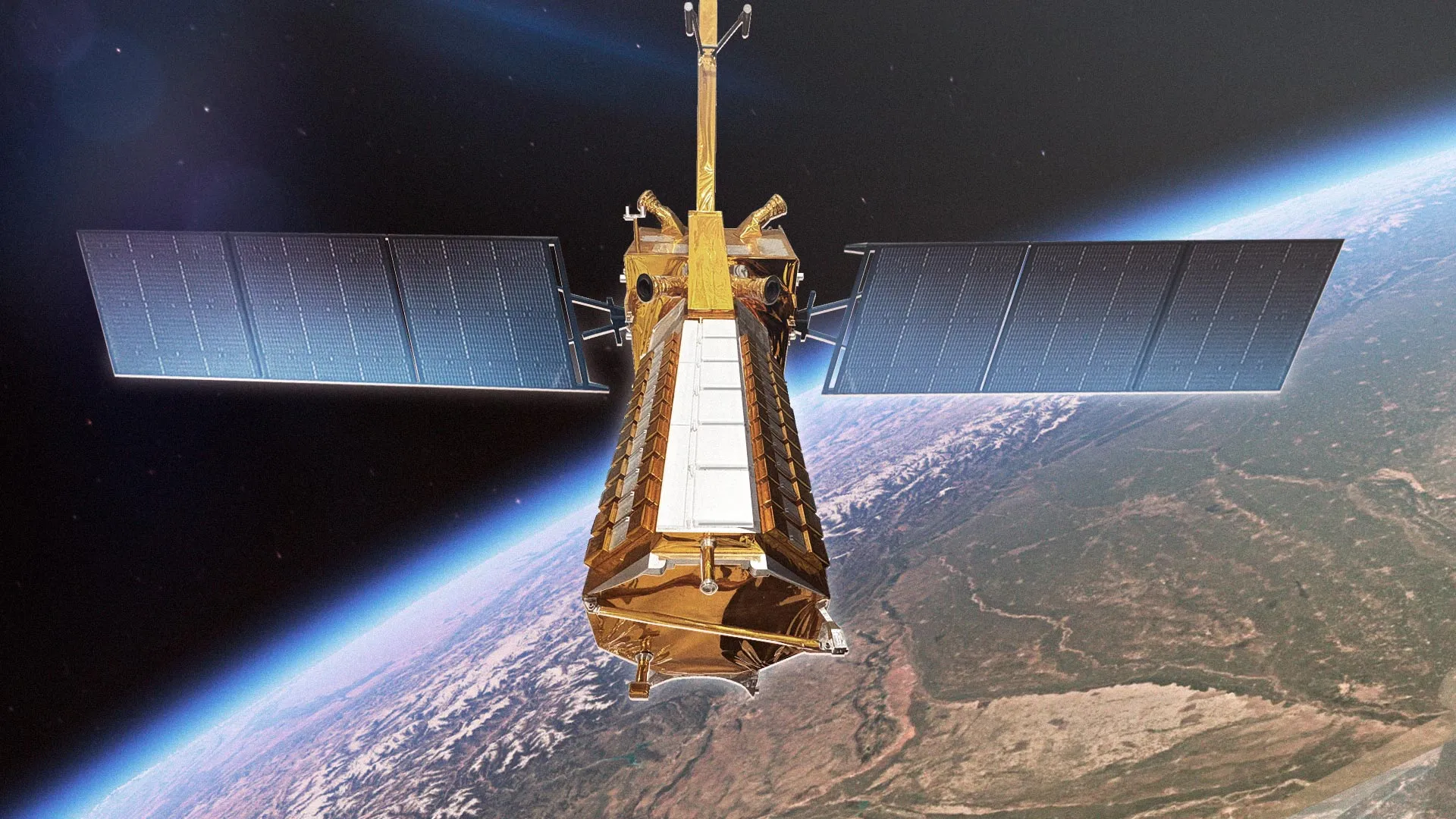
The first-ever hardware collaboration between NASA and ISRO on an Earth-observing mission, NISAR will carry the most advanced radar system ever launched as part of a NASA or ISRO mission.
About the length of a pickup truck, the satellite’s main body contains engineering systems and a first-of-its-kind dual-radar payload — an L-band system with a 10-inch (25-centimeter) wavelength and an S-band system with a 4-inch (10-centimeter) wavelength. Each system’s signal is sensitive to different sizes of features on Earth’s surface, and each specializes in measuring different attributes, such as moisture content, surface roughness, and motion. These characteristics are important for studying a variety of natural surface conditions, such as the amount of soil moisture available for vegetation to thrive or if land has subsided over time.
When operating together, the satellite’s two radars will collect data synchronized in time and location, extending the sensitivity of the measurements to objects on the surface in a broad range of sizes. For example, S-band data will allow more accurate characterization of shorter plants, such as bushes and shrubs, while L-band data will sense taller vegetation, like trees.
The spacecraft will operate in a Sun-synchronous orbit, with its radar antennas pointed in a configuration that will also offer unprecedented coverage of Antarctica. This is crucial for studying the motion, deformation, and melting of the Antarctic ice sheet as it breaks up and deposits fresh water into the ocean.